Oxnard weatherWhat’s on in Oxnard →Events →
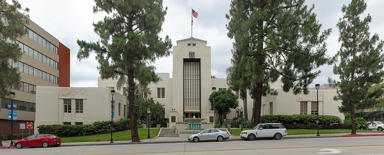
Burbank

Get out of town

Day trips from Oxnard

17 nearby parks, towns and places to explore, ordered by straight-line distance.

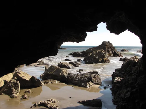
Leo Carrillo State ParkState park

Leo Carrillo State Park

17 miles southeast · straight-line distance

State park in California, United States.

Confirm the visitor entrance, hours, reservations, access and seasonal conditions. Islands or water destinations may require different transport.
Simi ValleyTown

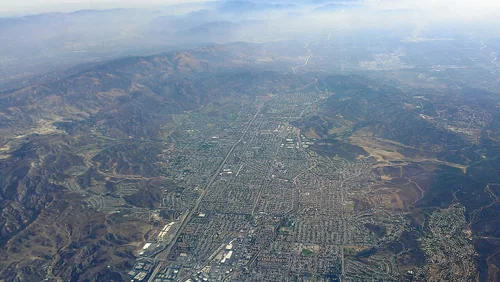
Simi Valley

26 miles east · straight-line distanceAbout 40 min by car (30 road miles, typical traffic, checked October 2026)

City in Ventura County, California, United States.

Confirm the visitor entrance, hours, reservations, access and seasonal conditions. Islands or water destinations may require different transport.
State park

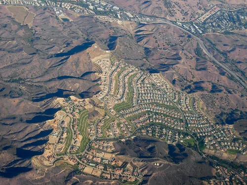
Malibu Creek State Park

27 miles east · straight-line distance

State park of California, United States.

Confirm the visitor entrance, hours, reservations, access and seasonal conditions. Islands or water destinations may require different transport.
CalabasasTown

Calabasas

30 miles east · straight-line distanceAbout 40 min by car (38 road miles, typical traffic, checked October 2026)

City in the northwestern Santa Monica Mountains region of Los Angeles County, California, United States.

Confirm the visitor entrance, hours, reservations, access and seasonal conditions. Islands or water destinations may require different transport.
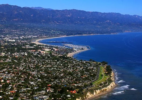
Santa BarbaraTown

Santa Barbara

34 miles northwest · straight-line distanceAbout 40 min by car (40 road miles, typical traffic, checked October 2026)

City in and county seat of Santa Barbara County, California, United States.

Confirm the visitor entrance, hours, reservations, access and seasonal conditions. Islands or water destinations may require different transport.
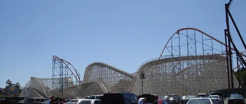
Six Flags Magic MountainThings to do

Six Flags Magic Mountain

37 miles northeast · straight-line distanceAbout 55 min by car (46 road miles, typical traffic, checked October 2026)

Theme park located in Valencia, California.

Confirm the visitor entrance, hours, reservations, access and seasonal conditions. Islands or water destinations may require different transport.
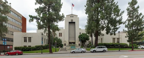
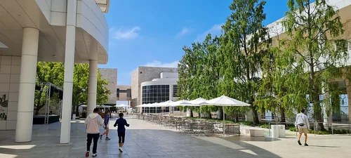
Getty CenterThings to do

Getty Center

41 miles east · straight-line distanceAbout 55 min by car (52 road miles, typical traffic, checked October 2026)

Campus of the Getty Museum and other programs of the Getty Trust in Los Angeles.

Confirm the visitor entrance, hours, reservations, access and seasonal conditions. Islands or water destinations may require different transport.
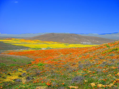
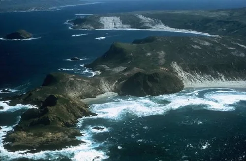
Channel Islands National ParkNational park site

Channel Islands National Park

46 miles southwest · straight-line distance

National park of the United States.

Confirm the visitor entrance, hours, reservations, access and seasonal conditions. Islands or water destinations may require different transport.
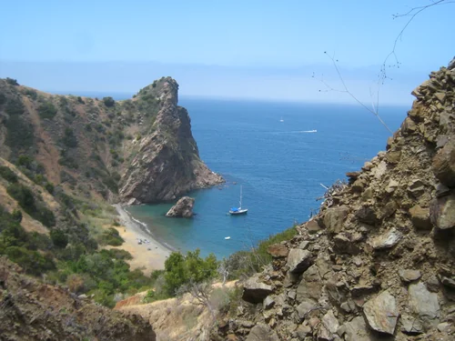
Things to do

La Brea Tar Pits

48 miles east · straight-line distanceAbout 1 hr 5 min by car (59 road miles, typical traffic, checked October 2026)

Protected area.

Confirm the visitor entrance, hours, reservations, access and seasonal conditions. Islands or water destinations may require different transport.
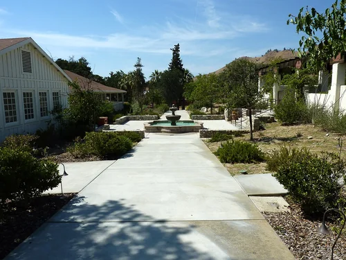
BurbankTown

Burbank

49 miles east · straight-line distanceAbout 1 hr by car (56 road miles, typical traffic, checked October 2026)

City in Los Angeles County, State of California, United States.

Confirm the visitor entrance, hours, reservations, access and seasonal conditions. Islands or water destinations may require different transport.
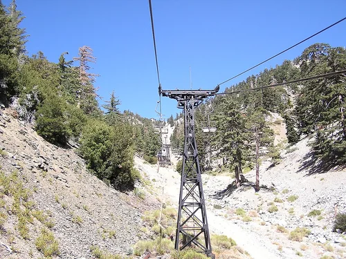
Antelope Valley California Poppy ReserveState park

Antelope Valley California Poppy Reserve

58 miles northeast · straight-line distance

Natural reserve in California.

Confirm the visitor entrance, hours, reservations, access and seasonal conditions. Islands or water destinations may require different transport.
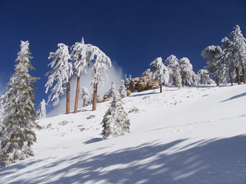
Outdoors

Cabrillo Beach

61 miles southeast · straight-line distanceAbout 1 hr 25 min by car (82 road miles, typical traffic, checked October 2026)

Public beach in San Pedro, Los Angeles, United States.

Confirm the visitor entrance, hours, reservations, access and seasonal conditions. Islands or water destinations may require different transport.

Santa Catalina IslandOutdoors

Santa Catalina Island

71 miles southeast · straight-line distance

Island in Los Angeles County, California, United States.

Confirm the visitor entrance, hours, reservations, access and seasonal conditions. Islands or water destinations may require different transport.

Cesar E. Chavez National MonumentNational park site

Cesar E. Chavez National Monument

79 miles northeast · straight-line distance

U.S. National Monument in Keene, Kern County, California.

Confirm the visitor entrance, hours, reservations, access and seasonal conditions. Islands or water destinations may require different transport.

Mount Baldy Ski LiftsSki area

Mount Baldy Ski Lifts

89 miles east · straight-line distanceAbout 2 hr by car (104 road miles, typical traffic, checked October 2026)

Ski resort in Southern California.

Confirm the visitor entrance, hours, reservations, access and seasonal conditions. Islands or water destinations may require different transport.

Outdoors

Bonita Falls

96 miles east · straight-line distance

Waterfalls on Bonita Creek in San Bernardino County, California.

Confirm the visitor entrance, hours, reservations, access and seasonal conditions. Islands or water destinations may require different transport.

Snow Valley Mountain ResortSki area

Snow Valley Mountain Resort

122 miles east · straight-line distanceAbout 2 hr 35 min by car (141 road miles, typical traffic, checked October 2026)

Ski resort in Running Springs, California, United States.

Confirm the visitor entrance, hours, reservations, access and seasonal conditions. Islands or water destinations may require different transport.

Driving times are typical estimates from the city center without live traffic, Powered by Geoapify · © OpenStreetMap contributors.

Distances are straight-line measurements from the city, not driving distance. Saved road estimates have no consistently recorded source date and are not current traffic; estimates to park centers, water locations or inconsistent routes are omitted. Named-destination route links are not verified entrances. Place descriptions come from Wikidata; photo credits below include recorded capture dates when available. A photograph does not show current conditions.

Outdoor places near Oxnard

40 recreation areas and campgrounds within 83 miles, from Recreation.gov. Filter by what you want to do.

Campground

Circle X Ranch Group Campground

15 miles southeast · straight-line distanceAbout 30 min by car (22 road miles, checked October 2026)National Park Service

Circle X Ranch Group Campground is closed until further notice. There is no estimated re-opening date.

BikingCampingClimbingHikingPicnickingWildlife viewing

Campground

Anacapa Island

17 miles southwest · straight-line distanceNational Park Service

Once visitors have scaled the rugged cliffs using the stairwell from the Landing Cove, they will be rewarded with a campground perched on the bluffs with magnificent coastal views.

BeachBirdingBoatingCampingFishingGuided Interpretive WalksHikingHistory

Recreation area

Lake Casitas

18 miles northwest · straight-line distanceBureau of Reclamation

Lake Casitas is formed by Casitas Dam , which is a feature of the Ventura Project . Lake Casitas Recreation Area offers one of the nations best bass fishing areas.

BikingBoatingCampingFishingHikingNature educationPicnickingRanger programs

Campground

Wheeler Gorge

22 miles north · straight-line distanceAbout 40 min by car (33 road miles, checked October 2026)USDA Forest Service

Wheeler Gorge Campground is a great place for families to explore the Los Padres National Forest all year long. Informative tours of the area are led by forest rangers at the nearby visitor center.

BikingCampingFishingHikingSwimming

Campground

Holiday Group Campground

23 miles north · straight-line distanceAbout 40 min by car (34 road miles, checked October 2026)USDA Forest Service

Holiday Group Campground is a relaxing location to enjoy nature all year long; a quick escape from the bustle of the city. It provides access to a variety of recreational opportunities, including hiking, biking and horseback riding.

BikingCampingHikingRanger programsSwimming

Campground

Rose Valley Campground

23 miles north · straight-line distanceAbout 55 min by car (43 road miles, checked October 2026)USDA Forest Service

Break free from reality and take a scenic cruise along fabulous Highway 33 for a short drive from Ojai to Rose Valley Campground and Day Use Area.

BikingCamping

Campground

Middle Lion Campground

24 miles north · straight-line distanceAbout 1 hr by car (45 road miles, checked October 2026)USDA Forest Service

Leave the city vibe behind as you meander down a winding, partially paved, narrow road that leads you into wooded Middle Lion Campground and day use area. Relax next to the running creek, take a refreshing dip, or hike the nearby trails.

BikingCamping

Campground

Santa Cruz Island Scorpion

24 miles southwest · straight-line distanceNational Park Service

Fantastic ocean views and relaxing beach time is practically guaranteed at Scorpion Canyon Campground, the most family-friendly campsite on Santa Cruz Island.

BeachBirdingBoatingCampingEvening ProgramsFishingGuided Interpretive WalksHiking

Recreation area

Santa Monica Mountains National Recreation Area

24 miles east · straight-line distanceNational Park Service

The Santa Monica Mountains offer easy access to surprisingly wild places. Experience the famous beaches of Malibu or explore more than 500 miles of trails.

BikingCampingClimbingHikingHorseback riding

Recreation area

Hopper Mountain National Wildlife Refuge

26 miles northeast · straight-line distanceFish and Wildlife Service

A high mountain valley encircled by deep canyons, steep ridgelines, and rocky pinnacles, Hopper Mountain National Wildlife Refuge is the gateway into California condor country.

Ranger programs

Campground

Reyes Peak Campground

31 miles north · straight-line distanceAbout 1 hr 20 min by car (62 road miles, checked October 2026)USDA Forest Service

At an elevation of 7,000 feet, Reyes Peak Campground, rises above the Sespe Wilderness and is situated along a ridge with spectacular views of the Cuyama Badlands on one side and the Pacific Ocean from the other side.

BikingCamping

Campground

Santa Cruz Island Del Norte Backcountry

31 miles southwest · straight-line distanceNational Park Service

For a truly remote getaway full of backpacking and breathtaking scenery, take a backcountry trip to Santa Cruz Island's Del Norte Campground. Del Norte is currently the only backcountry campground on Santa Cruz Island.

BackpackingBirdingCampingHikingPhotographyWildernessWildlife viewing

Campground

Pine Mountain Campground

32 miles north · straight-line distanceAbout 1 hr 15 min by car (61 road miles, checked October 2026)USDA Forest Service

Perfectly situated high above the Sespe Wilderness offering stunning views of the valley below and the Channel Islands in the distance lies Pine Mountain Campground.

BikingCamping

Campground

Reyes Creek Campground

34 miles north · straight-line distanceAbout 1 hr 25 min by car (67 road miles, checked October 2026)USDA Forest Service

Hammock spots, dipping holes and a fishing stream make Reyes Creek Campground an ideal hideaway. Located near the Sespe Wilderness alongside Reyes Creek you will find renewal and replenishment, Reyes Creek-style.

BikingCampingFishing

Recreation area

Los Padres National Forest

37 miles northwest · straight-line distanceUSDA Forest Service

BikingCampingClimbingHikingOff-highway vehiclesPicnickingSwimmingWater sports

Campground

Rancho Nuevo Campground

37 miles north · straight-line distanceAbout 1 hr 25 min by car (66 road miles, checked October 2026)USDA Forest Service

Rancho Nuevo Campground is a primitive campground with 2 sites on a grassy canyon bottom, 4-wheel drive access only. Road is subject to close in the winter.

Camping

Campground

Pyramid Lake - Emigrant Landing Day Use Area

39 miles northeast · straight-line distanceUSDA Forest Service

This facility does not accept reservations. Emigrant Landing is the largest day use recreation area on beautiful Pyramid Lake. Located just 90 minutes from Los Angeles, it is the perfect getaway without the long drive.

BoatingCampingFishingWater sports

Campground

Pyramid Lake - Los Alamos Campground

39 miles northeast · straight-line distanceUSDA Forest Service

Los Alamos Campground is located 90 minutes from Los Angeles, offering a restful experience without the lengthy travel time.

BikingBoatingCampingFishingHikingSwimmingWater sportsWildlife viewing

Recreation area

Sepulveda Dam

40 miles east · straight-line distanceUS Army Corps of Engineers

The Sepulveda Dam's recreation facilities are managed by the City of Los Angeles Parks.

BikingBoatingPicnickingWater sportsWildlife viewing

Campground

Upper Oso Campground

41 miles northwest · straight-line distanceUSDA Forest Service

Upper Oso Campground provides ample opportunity for exploration of California's coastal mountains. It is a family-friendly campground, equipped with equestrian sites, and is close to a variety of trails and several mountain streams.

BikingCampingFishingHikingHorseback ridingSwimming

Campground

Sage Hill

42 miles northwest · straight-line distanceAbout 1 hr by car (57 road miles, checked October 2026)USDA Forest Service

Nestled in the Santa Ynez Mountain Range, Sage Hill Campground is a great group camping spot with easy access to the Santa Ynez River.

CampingFishingHikingHorseback ridingHuntingSwimming

Recreation area

Channel Islands National Park

44 miles west · straight-line distanceNational Park Service

Channel Islands National Park encompasses five remarkable islands and their ocean environment, preserving and protecting a wealth of natural and cultural resources.

BoatingCampingDivingFishingHikingPaddlingPicnickingSnorkeling

Recreation area

Hansen Dam

45 miles east · straight-line distanceUS Army Corps of Engineers

The City of Los Angeles manages the extensive day-use facilities, including golf and riding stables, are available at this site in the San Fernando Valley.

BoatingHikingHorseback ridingPicnickingWater sportsWildlife viewing

Recreation area

Channel Islands National Marine Sanctuary

48 miles west · straight-line distanceNational Oceanic and Atmospheric Administration

The waters that swirl around the five islands within Channel Islands National Marine Sanctuary create a special place for several species of plants and animals.

BoatingDivingFishingKayakingPaddlingPhotographyRanger programsSnorkeling

Recreation area

Cachuma Lake

53 miles northwest · straight-line distanceBureau of Reclamation

Cachuma Reservoir, formed by Bradbury Dam , offers a prime recreational opportunity for the south central coast area of California.

BikingBoatingCampingFishingHikingHorseback ridingHotel/Lodge/Resort Fs OwnedNature education

Recreation area

Traver Ranch

64 miles north · straight-line distanceBureau of Land Management

The Traver Ranch was established in the 1940's when the family purchased approximately 800 acres and began building the large block house that still stands along the edge of Soda Lake Road.

HikingHorseback ridingPhotographyRanger programsWildlife viewing

Recreation area

Angeles National Forest

65 miles east · straight-line distanceUSDA Forest Service

BikingCampingFire Lookouts/Cabins OvernightHikingHorse CampingHorseback ridingOff-highway vehiclesPicnicking

Recreation area

Whittier Narrows Dam

65 miles east · straight-line distanceUS Army Corps of Engineers

This project is managed by Los Angeles County Parks and the City of Pico Rivera. Whittier Narrows has no permanent pool.

BikingBoatingHorseback ridingPicnickingWater sportsWildlife viewing

Recreation area

Carrizo Plain National Monument

67 miles northwest · straight-line distanceBureau of Land Management

All vehicles including UTVs on the monument must be street-legal (DMV plated) and all vehicles must stay on roads. REMINDER: Please follow warning signs and respect private property when visiting your public lands.

BikingCampingHorseback ridingHuntingNature educationPhotographyWildlife viewing

Recreation area

Temblor Recreation Area

67 miles north · straight-line distanceBureau of Land Management

Temblor Recreation Area was newly designated in the Bakersfield RMP (December 2014) and provides opportunities for OHV riding on a network of over 200 miles of designated routes, recreational shooting, hunting, and other dispersed forms of…

BikingCampingHikingHorseback ridingHuntingOff-highway vehiclesPhotographyWildlife viewing

Recreation area

Van Matre Ranch

67 miles northwest · straight-line distanceBureau of Land Management

The Van Matre family owned several farm properties throughout the plain. This property, known to them as "The Camp" was orginally homesteaded by Jerry Hagerty in 1930.

HikingHorseback ridingPhotographyWildlife viewing

Recreation area

Santa Fe Dam

69 miles east · straight-line distanceUS Army Corps of Engineers

Facilities at Santa Fe are operated by Los Angeles County Parks. Swimming, fishing, non-power boating, hiking and picnicking are available. Of interest are the five distinct biological communities within the area.

BoatingFishingPicnickingWater sportsWildlife viewing

Recreation area

Seal Beach National Wildlife Refuge

71 miles southeast · straight-line distanceFish and Wildlife Service

Established in 1972, Seal Beach National Wildlife Refuge is managed by the U.S. Fish & Wildlife Service to protect vital coastal habitats for rare and endangered species.

Ranger programs

Recreation area

Brea Dam

75 miles east · straight-line distanceUS Army Corps of Engineers

The recreation facilities at this project are managed by the City of Fullerton (CA) Community Services. Golf and tennis are main attractions at this project, located among the picturesque rolling hills in the City of Fullerton.

BikingHikingHorseback ridingHotel/Lodge/Resort Privately OwnedPicnicking

Recreation area

Fullerton Dam

77 miles east · straight-line distanceUS Army Corps of Engineers

Managed by Orange County, CA, there are facilities fishing, picnics, nature exhibits, handball and field sports. No permanent pool.

PicnickingWildlife viewing

Recreation area

Painted Rock

77 miles northwest · straight-line distanceBureau of Land Management

The sandstone formation at Painted Rock has long drawn the attention of Carrizo Plain National Monument visitors. About 3,000 - 4,000 years ago, Native Americans began to paint their sacred images with the alcove of the rock.

HikingWildlife viewing

Recreation area

Carbon Canyon Dam

79 miles east · straight-line distanceUS Army Corps of Engineers

Managed by Orange County, there is no permanent pool, but varied facilities such as fishing, picnic areas, a nature trail, and tennis. The site of the historic oil boom town of Olinda. Adjoins Chino Hills State Park.

FishingHikingPicnickingWildlife viewing

Recreation area

Goodwin Education Center

79 miles northwest · straight-line distanceBureau of Land Management

The center offers the visitor interpretive displays and exhibits explaining the uniqueness of the Carrizo Plain and adjoining Elkhorn Plain.

Nature educationPhotographyRanger programsWildlife viewing

Recreation area

Saucito Ranch

79 miles northwest · straight-line distanceBureau of Land Management

The El Saucito Ranch house is the oldest standing house in the Carrizo Plain National Monument, dating back to circa 1878. This is the only ranch house in the monument to have been occupied from the pioneer period to modern day.

HikingHorseback ridingPhotographyRanger programsWildlife viewing

Recreation area

Soda Lake Overlook

83 miles northwest · straight-line distanceBureau of Land Management

A normally dry lake bed, covers an area of about 3,000 acres. It is the largest remaining natural alkali wetland in southern California and the only closed basin within the coastal mountains.

HikingHorseback ridingPhotographyWildlife viewing

Recreation areas and campgrounds from Recreation.gov's directory, checked October 9, 2026. Listings are not live availability: check Recreation.gov or the managing agency for open dates, fees, reservations and conditions. Directions go to the listed coordinates, which may not be the entrance. Campground driving times: Powered by Geoapify · © OpenStreetMap contributors.

Questions

What day-trip ideas are near Oxnard?

This guide includes Leo Carrillo State Park, Simi Valley, Malibu Creek State Park, Calabasas, Santa Barbara. Places are ordered by straight-line distance. Confirm visitor access, opening hours and current travel conditions before choosing a trip.

How far is Leo Carrillo State Park from Oxnard?

Approximately 17 miles southeast in a straight line. This is not current traffic or a route to a verified visitor entrance. Use the named destination and confirm the appropriate entrance or transport.

How far is Simi Valley from Oxnard?

Approximately 26 miles east in a straight line; driving takes about 40 min over 30 road miles in typical traffic (Geoapify, checked October 2026). This is not current traffic or a route to a verified visitor entrance. Use the named destination and confirm the appropriate entrance or transport.

How far is Malibu Creek State Park from Oxnard?

Approximately 27 miles east in a straight line. This is not current traffic or a route to a verified visitor entrance. Use the named destination and confirm the appropriate entrance or transport.

Where can I camp near Oxnard?

Recreation.gov lists 16 campgrounds within 42 miles, including Circle X Ranch Group Campground (15 miles southeast), Anacapa Island (17 miles southwest), Wheeler Gorge (22 miles north). Check Recreation.gov for current availability, seasons and reservations.

Local events, things to do, and independent businesses worth knowing.

Oxnard AI

Your Oxnard local guide
Hey there!

I'm Oxnard AI. Ask me about local food, things to do, shopping, or a day by the harbor.

AI recommendations may be inaccurate. Verify hours and prices. Questions are processed by Cloudflare. Privacy